
Crash course
PennDOT database shows region's accident-prone areas
Trending
The ice is gone but that doesn't mean the roads are safer.
Only 311 of 7,122 reportable crashes in Blair County since 2013 -- 4 percent -- involved icy roads, according to PennDOT data that is gathered from police reports. Wet roads were involved in about 17 percent of crashes.
Reportable crashes involve injury or require a vehicle to be towed. Police interviewed for this story noted that PennDOT's crash data does not include minor fender benders, crashes where no one is hurt or vehicles that can be driven away.
PennDOT's online crash query tool can show specific spots countywide that have collected crashes over the span of several years. A majority of them happened on dry roads.
Users of the website can sort data to show a countywide map of any type of reportable crash. Locations of crashes are marked by colored symbols showing the severity of the crash.
A bird's-eye view of all 24 municipalities in Blair County shows, naturally, that the more densely populated municipalities rack up more crashes countywide.
In a four-year span from January 2013 to December 2017, there were 7,122 reportable crashes in the county. Data for 2018 and 2019 is not yet available.
About 36 percent of the crashes happened in the city of Altoona, about 15 percent in Logan Township and 9 percent in Allegheny Township, which includes busy Plank Road.
The more rural areas had fewer crashes. Freedom Township racked up a little more than 4 percent of all the county's total crashes, but certain spots appear to be crash magnets.
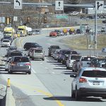
Perhaps most notably in Freedom Township is a pattern of rear-end crashes both ways in a 2-mile stretch from the Taylor Township part of Woodbury Pike near Yerty's Auto Services & Parts to the Dunnings Highway intersection at the traffic light near WalMart.
There was one fatal crash there in 2014, but about 90 total reportable crashes causing injury or requiring a tow, township police Chief Terry Dellinger said. That's more than 30 percent of the more than 300 reportable crashes in the township since 2013 and about one reportable crash per month. But Dellinger laughed at those numbers. The data does not include the untold number of non-reportable crashes.
"There are hellacious rear-end crashes there," he said. "I don't know the answer."
Dellinger and PennDOT engineers don't understand the propensity for rear-end accidents there. Nor do they know how to lessen the chance of accidents.
During the past couple of years, Dellinger said he has been working with PennDOT to get new, flashing signs that read "heavy congestion ahead" on either end of the stretch.
But, "it's that there's no money -- one of those things," he said. "How much can it cost?"
In general, roadways are not dangerous, PennDOT engineer Jim Hughes said. Driver choices are.
In Freedom Township, more signs could be overkill.
"There's the question, 'at what point is that not effective?'" Hughes said.
"The problem is people are traveling fast and not paying attention. I do know we have a project in design to try to get a study done, to bring a consultant, to see if improvements can be made there," he said.
The serpentine Johnstown Road in Freedom Township has snared many drivers over the years, even a criminal in a stolen vehicle who crashed and was later apprehended, Dellinger said.
From January 2013 to December 2017, there were five crashes resulting in suspected serious injury or death on an 800-yard long part of that road, the equivalent of less than two laps around a running track.
The count increases to 22 crashes over the four years if those resulting in lesser injury or property damage are included along the entire road. Although many of those crashes happened in wet or snowy conditions, crashes also happened when the road was dry, including a June 2014 fatal.
The two crashes involving fatalities happened within about a year of each other, a sideswipe on a dry June day in 2014 and a collision with an object on a rainy October day in 2015.
River Road in Blair Township is only 2 miles long, barely residential, and the average daily traffic count is so small PennDOT doesn't have a record of it.
But two fatalities have occurred in recent years there, within 300 feet of each other.
Blair Township Police Chief Roger White said police write a substantial number of citations there compared to more inhabited areas.
"There are not a whole lot of crashes but there were two fatalities there. Most of the accidents involve speed -- excessive speed. The limit is 35 miles an hour.
"The uniqueness of that is that it's not heavily populated. I think that's what lends itself to extra speed. People are in a hurry," he said. "They take River Road to avoid going through Route 22 to go to Hollidaysburg from Rolling Hills. There's not a lot of houses there … but of course there are fatalities there. One fatality is too many."
On a 2-mile stretch of I-99 in the area of Route 865 and Skelp Mountain Road there were four fatal crashes since 2013, all but one in dry road conditions.
Hollidaysburg State Police Community Service officer, Trooper Joseph Dunsmore, said state police keep a database of crashes.
"A vast majority of crashes come down to driver error," he said.
He took a cursory look at the PennDOT data, a list of crashes and where they were located.
Dunsmore speculated the crashes had more to do with distracted driving than any physical danger.
"If I can avoid going to a fatal crash, I would love to do so." He said the worst part of his job is knocking on a stranger's door to tell them a family member passed away in a traffic accident.
He remembered one such call earlier in his career in another part of the state.
"There was a woman in her 30s who was in a fatal crash. She resided with her parents. A juvenile opened the door. The 13-year-old was home alone. I sat there with him for over an hour until his grandparents got home," he said.
"Anywhere we are trying to get to, slowing down a couple miles an hour greatly increases our odds of getting there safely," he said.
Police and PennDOT categorize crashes by terms including "hit fixed object."
"Ninety-nine percent of the time, hitting a fixed object means it's a vehicle leaving the roadway" and hitting a guardrail or tree, Dunsmore said.
While there are times where PennDOT improves roads to increase safety -- the recent Route 22 Frankstown Intersection Project in Frankstown Township, for example -- there are a lot of specifications an area must meet to qualify for a change.
Hughes said a speed limit study only requires a request.
But safety studies for physical changes to roads all depend on the crash type, how many have occurred in a certain period of years and the distance between them.
"We try to look for the same type of crash. There are four different crash types. We look for concentrations of the same type," Hughes said. "Just because there are a lot of crashes doesn't mean there is anything you can do."
Mirror Staff Writer Russ O'Reilly is at 946-7435.
Key F Fatal S Suspected serious injury
Wet & dry indicates road conditions at the time of
the crash. There are four different categories PennDOT applies to crashes -- angle, head on, hit fixed object and sideswipe
Crashes in the same spot
Plank Road & Sheraton Drive (near Wal-Mart) Allegheny Twp.
F August 2017, angle, dry
S March 2017, angle, dry
S Dec 2015, rain sideswipe, wet
S Feb. 2016, dry
About 100 feet away from those accidents was another serious injury crash during rainy conditions
Janesville Pike
F April 2016, hit fixed object, dry
S May 2013, hit fixed object, dry
(Expanded to 300 feet at this turn, there are six other injury crashes including two non-collision crashes in the same spot
2015 and 2017, one wet and one dry.)
Cross Cove Road & Woodbury Pike
F May 2013, angle, wet road
F June 2017, angle, dry
S March 2014, angle, dry
(distance about 500 feet from that spot: Woodbury Pike and Sparrow Lane)
F June 2015, dry
Distance: Under 50 feet
Locke Mountain Road Hollidaysburg near Fine-line Cabinets
S Feb. 2014, non-collision, dry
F May 2016, hit fixed object, dry No adverse conditions
Distance: Under 100 feet
Walton Avenue near intersection of Pottsgrove Road
S Jan. 2015, hit pedestrian, dry
S Aug. 2015, angle, dry
Distance:
250-300 feet
Hollidaysburg, River Road
F Dec 2014, hit fixed object, wet
F Aug. 2017, hit fixed object, dry
Route 22 (William Penn Highway) Catharine Township near
Canoe Mountain Drive
F May 2015, hit fixed object, dry (impaired driver, two fatalities)
S April 2017, angle, dry
22nd Street between 1st Ave & Crawford Ave
S May 2017, hit fixed object, dark, dry
S May 2017, angle, daylight, dry
Grazierville,
E. Pleasant Valley Boulevard, near intersection of 2nd Street.
F March 2013, sideswipe, wet
F January 2015, hit pedestrian, wet
Old Sixth Ave
(near Greenwood Road)
F Feb 2013, side swipe, dry
F July 2016, hit fixed object, dry
Distance: 600 feet
Intersection of Col. Drake Highway and Skyline Drive (Logan Township)
S Nov. 2014, angle, snow/wet
F June 2017, angle, dry
Newry, Bedford Street between area near intersection of Donegal Lane
and intersection of Patrick Lane
F Dec. 2013, hit fixed object, rain, impaired driver
S Aug. 2014, angle, dry
Distance: 800 feet
Newry, I-99 near Catfish Road
F April 2014, sideswipe, wet, rain
S June 2016, hit fixed object, dry
Distance: One half mile
Johnstown Road (Route 164) near Polecat Road
F Oct 2015, hit fixed object, rain
S July 2016, sideswipe, rain
S July 2015, hit fixed object, dry
S Jun 2013, hit fixed object, dry
F June 2014, sideswipe, dry
Piney Creek Road
F April 2015– head on, dry
F Oct 2013–hit fixed object, wet
Cove Mountain Road
F Oct 2015 head-on, dry
F Oct 2015, wet/rain
Col. Drake Highway
near Mill Run Road
F Aug 2013, angle, rain
S Dec 2017–head on, ice patches
Distance: Less than 2 miles
Seventh Ave -- from
Union Ave to Third Street intersections
Union Ave
F June 2013
24th street
F July 2013, dry
S 19th street
S Oct. 2016, dry
13th street
S June 2013 rear-end, dry,
impaired driver
17th Street
S June 2016, angle, dry
8th street dry
S Aug. 2014, angle
3rd street dry
S Oct. 2013, rear end, four cars, dry
Sixth Ave from Union Ave to 3rd St intersections:
Union Ave
S Feb. 2017, sideswipe, dry
S May 2014, hit fixed object, dry
17th Street
F Feb 2013, angle, dry
13th street
F Nov. 2013, hit fixed object, wet/raining
5th street
F June 2016, angle, dry
3rd Street
S Dec. 2014, dry, hit pedestrian
I-99, Exit 41
Route 865 and Skelp Mountain Road
F May 2014, rear-end, dry
F July 2015, angle, dry
F Oct 2014, non-collision, dry
F Sept. 2016, sideswipe wet
Distance: Over
2 miles
Sugar Run Road
S Jan 2017, hit fixed object, dry
F Aug. 2015, head on, dry
S Oct. 2015, hit fixed object, dry
S Dec. 2015, non collision, wet
S Oct 2015, hit fixed object, dry
S Aug. 2017, hit fixed object, rain
S Dec. 2016, hit fixed object, ice
S Jan. 2014, hit fixed object, snow
F Dec. 2013, sideswipe, dry