Digging out: Region recovers from snowstorm as potential second system nears
-
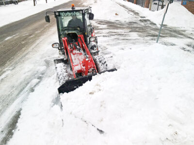
- Mike Walters of the Hollidaysburg Area School District groundskeeping/maintenance department cleans up the parking lot next to Tiger Stadium along Montgomery Street on Tuesday afternoon. Mirror photo by Patrick Waksmunski
-

- Kayla Robertson, 12, eats a slice of her free pizza at Claysburg Pizza on Tuesday afternoon. Mirror photo by Patrick Waksmunski
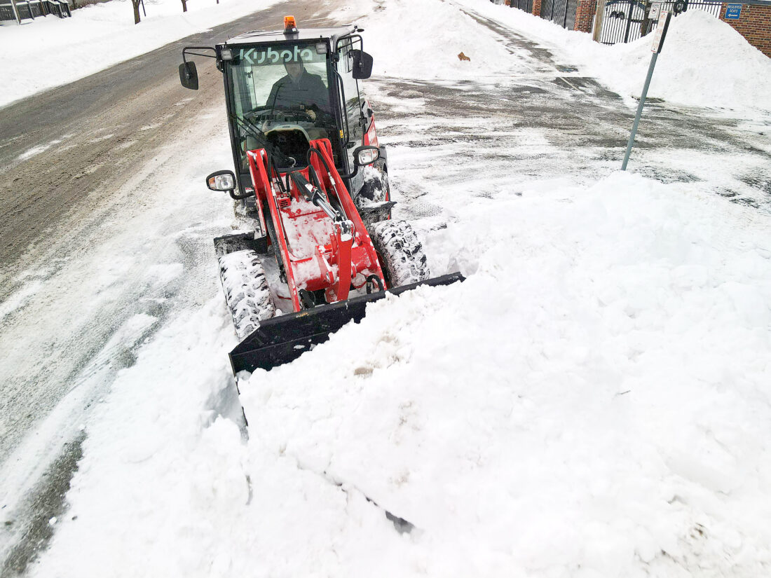
Mike Walters of the Hollidaysburg Area School District groundskeeping/maintenance department cleans up the parking lot next to Tiger Stadium along Montgomery Street on Tuesday afternoon. Mirror photo by Patrick Waksmunski
Local officials are relieved about the smooth response to last weekend’s snowstorm that dropped up to 18 inches on parts of Blair County, even as a new storm could offer a second strike.
Coordinated response
According to Blair County 911 coordinator Emily States, “everything ran smoothly” during the weekend storm.
The county 911 center had extra staff on hand to handle an influx of calls, and local first responders increased their staffing levels in kind, States said.
Having a substantial amount of advanced warning about the timing and intensity of the storm helped a lot, States said, for both emergency services professionals and citizens.

Kayla Robertson, 12, eats a slice of her free pizza at Claysburg Pizza on Tuesday afternoon. Mirror photo by Patrick Waksmunski
PennDOT District 9 spokesperson Monica Jones said that a “all hands on deck” call with statewide EMS, PennDOT, Pennsylvania Turnpike Commission and representatives from neighboring states held on Friday morning allowed for a well-coordinated response to the storm.
Because of this level of advanced preparation, PennDOT had a full complement of plow truck drivers and maintenance technicians on-hand over the weekend to ensure smooth and efficient snow management, Jones said.
“It wasn’t a secret, it was a national story so we had plenty of heads-up to brace for it, which only enhanced the ease of which PennDOT was able to work,” she said.
PennDOT implemented a Tier 4 Weather Event/Speed Restriction Plan ahead of the storm, which was a “huge help” across the board.
The five-tier plan allows PennDOT to impose increasingly strict controls on what type of vehicles are able to legally access state roads during severe weather, with only passenger trucks, cars and emergency responders permitted to drive during Tier 4 restrictions.
Residents of south-central Pennsylvania spent Monday and Tuesday digging out their cars and returning to work, even as several businesses and local school districts remained closed.
Students of the Claysburg-Kimmel School District, who had off both days due to the weather, gathered at Claysburg Pizza on Dunnings Highway for free slices, as they were missing out on their free school lunch.
According to manager Keith Clowson, several members of the community reached out to the restaurant asking if they could help supplement the lost nutrition.
Clowson said his staff were eager to step up, having done similar no-cost events in the past.
Substantial snowfall
According to data from the National Weather Service, one report from Lakemont recorded more than 18 inches of snow, while just north of Altoona received about 10 inches over the weekend.
Cambria County saw a similar snowfall, with reported totals ranging from nearly seven inches up to 16.5 inches.
Bedford County received about 11 inches of snow, according to NWS data.
Centre County saw a wider variation in snowfall, from 7 reported inches in Millheim to more than 15 inches in Port Matilda.
National Weather Service lead meteorologist Matt Steinbugl described the storm as a “once in a season” occurrence ahead of its impact late on Jan. 24.
According to National Weather Service forecaster John Bowen, another weather system is currently brewing above the Atlantic Ocean that could bring an “impactful winter storm” to the region by the end of the week.
Bowen said that the storm will make its way up the East Coast throughout the week, reaching New Jersey by Sunday.
How far west or east the storm arrives is a key determining factor in how much snow it could deliver to central Pennsylvania, Bowen said.
According to Bowen, internal National Weather Service climate models are currently “in disagreement” regarding how much snow the region could receive, so it would be “irresponsible” to estimate a snowfall total this far out.
Bowen said it will take 24 to 48 hours until forecasters have enough data to make a confident prediction on any potential snowfall this coming weekend.
Jones said that PennDOT is currently unsure what level of preparation will be required ahead of the coming storm, since officials are still “hoping it misses us.”
“Until we know whether or not it will hit us, we can’t decide whether we need to plan or to breathe a sigh of relief,” Jones said.
Mirror Staff Writer Conner Goetz is at 814-946-7535.
Local News

Luthersburg teen to be tried in juvenile court
Pittsburgh anti-ICE sentiment growing
Local and state officials in the Pittsburgh region continue speaking out against U.S. Immigration and Customs ...

Martinsburg woman allegedly tried to kill husband

Joyce to run for re-election
Power load growth forecast drops slightly
With AI-powered data centers rapidly driving up demand for electricity, predicting future needs is essential for ...