Waiting game: Weekend storm may bring significant snowfall to region
-

- Mirror photo by Patrick Waksmunski PennDOT equipment operator Frank Moore checks the oil of his plow truck at the Bellwood stockpile before heading out on his route on Wednesday. Mirror photo by Patrick Waksmunski
-

- PennDOT equipment operator Frank Moore tidies up the pile of 50/50 salt mix at the Bellwood stockpile before heading out on his route on Wednesday afternoon. Mirror photo by Patrick Waksmunski
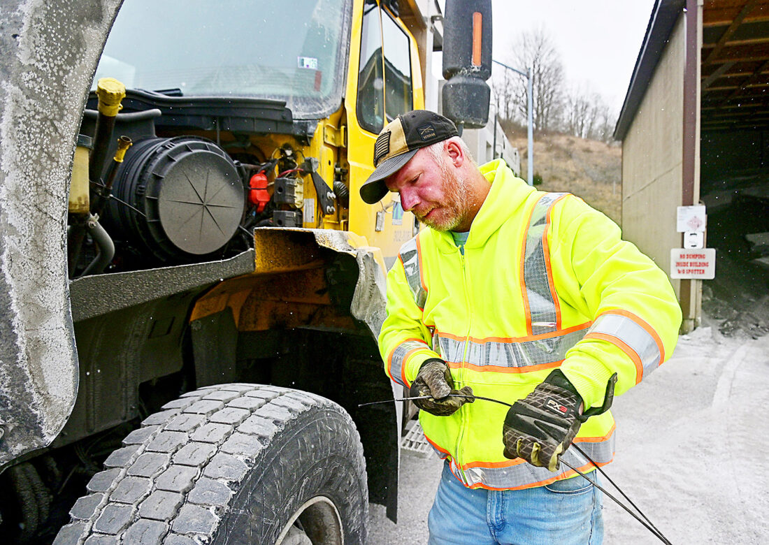
Mirror photo by Patrick Waksmunski PennDOT equipment operator Frank Moore checks the oil of his plow truck at the Bellwood stockpile before heading out on his route on Wednesday. Mirror photo by Patrick Waksmunski
Southcentral Pennsylvania is expected to be hit with a “once in a season” snow storm over the weekend and the news is prompting a wave of preparation across the region.
According to National Weather Service lead meteorologist Matt Steinbugl, the latest forecast indicates a “significantly heavy snow event” beginning Saturday night and lasting through late Sunday evening or early Monday morning.
This means a high probability of six inches or more of snow across the region, with the exact amount of snow dependent on the progression of the storm.
Some forecasts are predicting more than a foot of snow in many of the Mirror’s coverage areas, but Steinbugl said Wednesday that it’s much too early for those types of predictions.
The storm system is now above the Great Plains states west of Pennsylvania and will move east throughout the week.
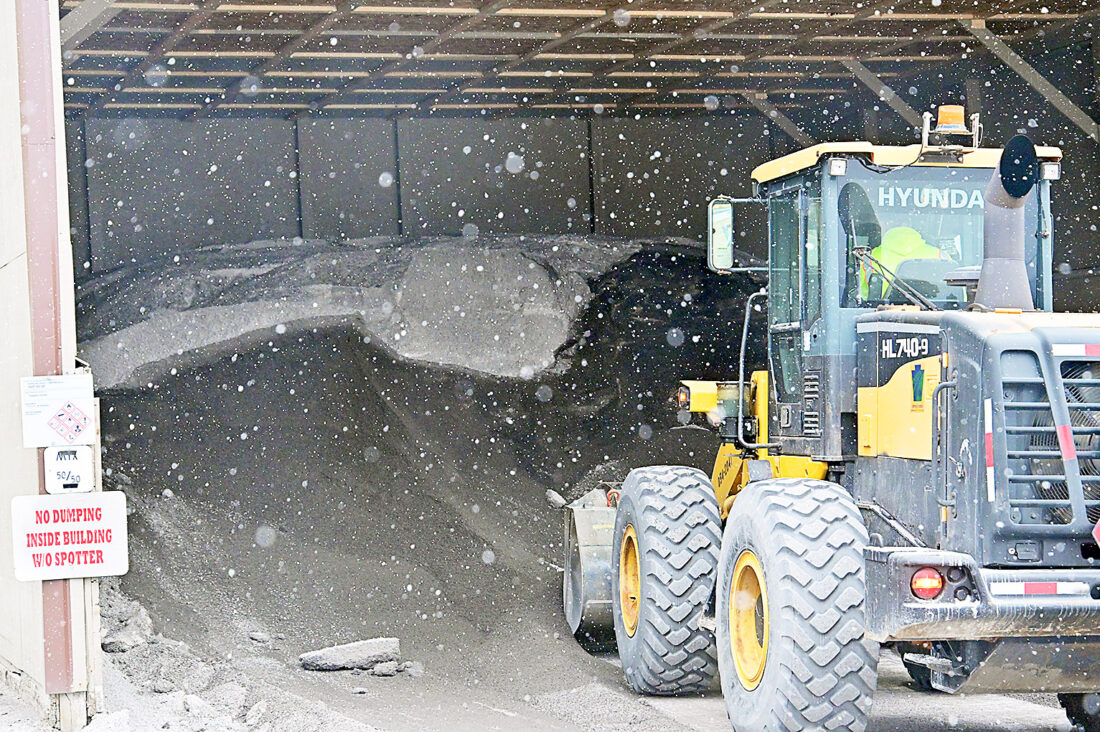
PennDOT equipment operator Frank Moore tidies up the pile of 50/50 salt mix at the Bellwood stockpile before heading out on his route on Wednesday afternoon. Mirror photo by Patrick Waksmunski
How far north or south the storm hits the East Coast is a key factor in how much snow the region could receive, according to a National Weather Service report.
A trajectory farther north could result in substantially more snow in central Pennsylvania, while a more southern route could spare the region from significant snowfall.
According to Steinbugl, the region typically experiences one storm per season that drops six or more inches of snow, so a storm of this size is not uncommon.
Previous storms have delivered two feet or more of snow, Steinbugl said, although those storms are not a common occurrence.
PennDOT District 9 press officer Monica Owens said a “full staff of salt and plow trucks” were being deployed Wednesday night to combat a smaller snow event, and trucks will be out Saturday ahead of the main storm.
PennDOT officials have been closely tracking the storm’s trajectory in anticipation of the “big hit” expected for this weekend, Owens said.
According to Owens, PennDOT officials, Turnpike Commission members, state emergency services staff and representatives from neighboring states’ departments of transportation are scheduled for a group coordination phone call on Friday.
There, the assembled attendees will discuss the storm, and how to best deploy their resources, Owens said.
Owens said that the conference call is an occasionally used tool for intergovernmental coordination when a storm is projected to affect 60% or more of the commonwealth.
PennDOT salt truck drivers will work about the clock starting Saturday to ensure that the approximately 4,000 miles of plowable highways in District 9 — which includes Bedford, Blair and Cambria counties — are safe and accessible throughout the weekend, according to Owens.
These trucks are equipped with technology to sense the temperature of the road surface, which is a critical factor in determining the most appropriate remedy to prevent ice and snow buildup.
According to Owens, when the road temperature drops into the single digits, the regular salt brine formulation becomes ineffective.
Then, truck drivers will switch to dispensing an anti-skid blend composed of crushed limestone and gravel, which will ensure appropriate traction for motorists.
Brittany McConnell, Bedford County director of emergency services, is closely monitoring the forecast for the latest updates on the storm’s progression.
McConnell plans to issue a press release sometime on Friday with updated information on the county’s plans for the storm.
Preparation advice
PennDOT said drivers should take care to check if their vehicle is in good working order before attempting any travel during winter storm conditions, noting it’s especially important to check windshield wipers, headlights and tires.
Those traveling should also wear extra-warm clothes in order to stay safe in the event of a breakdown that leaves them stranded on the roadside.
Drivers are advised to drive slower than normal, and give snow plow trucks a wide berth.
Owens said passing a plow truck in winter weather “can turn deadly” in an instant, as truck drivers have limited backward visibility.
Owens said that drivers should allocate extra time for trips so as to not speed in adverse conditions.
McConnell said residents should heed all warnings issued by local authorities and the National Weather Service throughout the weekend.
Checking the 511PA website, 511pa.com, is another useful resource for updates on road closures and travel advisories, McConnell said.
McConnell urged residents to check on elderly neighbors and to bring any outdoor pets indoors.
Mirror Staff Writer Conner Goetz is at 814-946-7535.